Showing posts with label Africa. Show all posts

Monday, December 2, 2013

Country Profiles: Côte d’Ivoire

Côte d’Ivoire is located in Africa.
Close ties to France following independence in 1960, the development of cocoa production for export, and foreign investment all made Côte d’Ivoire one of the most prosperous of the West African states but did not protect it from political turmoil. In December 1999, a military coup - the first ever in Côte d’Ivoire's history - overthrew the government. Junta leader Robert GUEI blatantly rigged elections held in late 2000 and declared himself the winner. Popular protest forced him to step aside and brought Laurent GBAGBO into power. Ivorian dissidents and disaffected members of the military launched a failed coup attempt in September 2002 that developed into a rebellion and then a civil war. The war ended in 2003 with a cease fire that left the country divided with the rebels holding the north, the government the south, and peacekeeping forces a buffer zone between the two. In March 2007, President GBAGBO and former New Forces rebel leader Guillaume SORO signed an agreement in which SORO joined GBAGBO's government as prime minister and the two agreed to reunite the country by dismantling the buffer zone, integrating rebel forces into the national armed forces, and holding elections. Difficulties in preparing electoral registers delayed balloting until 2010. In November 2010, Alassane Dramane OUATTARA won the presidential election over GBAGBO, but GBAGBO refused to hand over power, resulting in a five-month stand-off. In April 2011, after widespread fighting, GBAGBO was formally forced from office by armed OUATTARA supporters with the help of UN and French forces. Several thousand UN peacekeepers and several hundred French troops remain in Côte d’Ivoire to support the transition process. OUATTARA is focused on rebuilding the country's infrastructure and military after the five months of post-electoral fighting and faces ongoing threats from GBAGBO supporters, many of whom have sought shelter in Ghana. GBAGBO is in The Hague awaiting trial for crimes against humanity. CIA World Factbook
. With an area of 322,463 sq km, it is slightly larger than the U.S. state of New Mexico.

Côte d’Ivoire shares a border with Burkina Faso, Ghana, Guinea, Liberia, and Mali. It is mostly flat to undulating plains with mountains in the northwest..


People who live in Côte d’Ivoire are called Ivoirian, which is also an adjective used to describe something from this country. As of July 2013, there are 22,400,835 people in Côte d’Ivoire. The ethnic groups that reside in Côte d’Ivoire are mostly Akan (42%), with Voltaiques/Gur (17%), Northern Mandes (16%), Krous (11%), and Southern Mandes (10%). Though French is the official language, 60 native dialects are spoken - Dioula is the most widely spoken. Muslims make up approximately 38% of the population, while Christian (32%) and indigenous (12%) make up the rest, save the 16% that have none.

The country's official name is Republic of Côte d’Ivoire. The capital is Yamoussoukro, and the country is made up of 12 districts and 2 autonomous districts. The Côte d’Ivoire gained independence from the French on August 7, 1960. The current president is Alassane Dramane Ouattara. Information about the leaders of Côte d’Ivoire's government can be found on the Chiefs of State and Cabinet Members of Foreign Governments site (CIA). The currency is the Communaute Financiere Africaine francs (XOF), which stands at 510.29 XOF per USD as of 2012.


All of this information was gathered from the CIA World Factbook. For more information, check out these resources...

Côte d’Ivoire, CIA World Factbook

Côte d’Ivoire, U.S. Department of State

2012 Country Report on Human Rights Practices in Côte d’Ivoire, U.S. Department of State.

You can also check out the Country Studies tab on our Fed Docs libguide here for more resources on all of the countries.


Sonnet Ireland
Head of Federal Documents, Microforms, & Analog Media
Reference & Instruction Librarian
Liaison Librarian:

Accounting; Economics and Finance;
Hotel, Restaurant, and Tourism;
Legal Research; Management; Marketing

Monday, March 18, 2013

Country Profiles: Republic of the Congo

The Republic of the Congo is located in Africa.
Upon independence in 1960, the former French region of Middle Congo became the Republic of the Congo. A quarter century of experimentation with Marxism was abandoned in 1990 and a democratically elected government took office in 1992. A brief civil war in 1997 restored former Marxist President Denis SASSOU-Nguesso, and ushered in a period of ethnic and political unrest. Southern-based rebel groups agreed to a final peace accord in March 2003, but the calm is tenuous and refugees continue to present a humanitarian crisis. The Republic of Congo was once one of Africa's largest petroleum producers, but with declining production it will need new offshore oil finds to sustain its oil earnings over the long term.
CIA World Factbook
With an area of 342,000 sq km, it is slightly smaller than the U.S. state of Montana.

The Republic of the Congo shares a border with Angola, Cameroon, Central African Republic, Democratic Republic of the Congo, and Gabon. It has coastal plains, a southern basin, a central plateau, and a northern basin.


People who live in the Republic of the Congo are called Congolese, which (along with the word Congo) is also an adjective used to describe something from this country. As of July 2012, there are 4,366,266 people in the Congo. The ethnic groups that reside in the Congo are mostly Kongo 48%, with some Sangha 20%, M'Bochi 12%, Teke 17%, Europeans and other 3%. Several languages are spoken there French (official), Lingala and Monokutuba (lingua franca trade languages), many local languages and dialects (of which Kikongo is the most widespread). Christians make up approximately 50% of the population, while animists (48%) and Muslims (2%) make up the rest.

The country's official name is Republic of the Congo, but it is referred to as Congo. The capital is Brazzaville, and the country is made up of 10 regions. Though Congo gained independence from the French on August 15, 1960, a constitution was not drafted until 1992. The constitution can be found here through Constitution Finder. The current president is Denis Sassou-Nguesso. Information about the leaders of Congo's government can be found here. The currency is the Cooperation Financiere en Afrique Centrale francs (abbreviated XAF), which stands at 511.4 XAF per USD as of 2012.


All of this information was gathered from the CIA World Factbook. For more information, check out these resources...

Republic of the Congo, CIA World Factbook

Background Notes: Republic of the Congo, U.S. Department of State

2011 Country Report on Human Rights Practices in the Republic of the Congo, U.S. Department of State.

You can also check out the Country Studies tab on our Fed Docs libguide here for more resources on all of the countries.


Sonnet Ireland
Head of Federal Documents and Microforms
Reference & Instruction Librarian
Liaison Librarian:
Accounting; Hotel, Restaurant, and Tourism; Legal Research;
Marketing; Planning and Urban Studies; Political Science


Sonnet Ireland
Head of Federal Documents and Microforms
Reference & Instruction Librarian
Liaison Librarian:
Accounting; Hotel, Restaurant, and Tourism; Legal Research;
Marketing; Planning and Urban Studies; Political Science

Monday, March 11, 2013

Country Profiles: Democratic Republic of the Congo

The Democratic Republic of the Congo is located in Africa.
Established as a Belgian colony in 1908, the then-Republic of the Congo gained its independence in 1960, but its early years were marred by political and social instability. Col. Joseph MOBUTU seized power and declared himself president in a November 1965 coup. He subsequently changed his name - to MOBUTU Sese Seko - as well as that of the country - to Zaire. MOBUTU retained his position for 32 years through several sham elections, as well as through brutal force.
CIA World Factbook
With an area of 2,344,858 sq km, it is slightly less than one-fourth the size of the United States of America.

Democratic Republic of the Congo shares a border with Angola, Burundi, Central African Republic, Republic of the Congo, Rwanda, South Sudan, Tanzania, Uganda, and Zambia. It is a vast central basin is a low-lying plateau with mountains in east.


People who live in Democratic Republic of the Congo are called Congolese, which is also an adjective used to describe something from this country (Congo also describes an object from the country). As of July 2012, there are 73,599,190 people in the country. Over 200 African ethnic groups reside in the DRC, the majority of which are Bantu. The four largest tribes are Mongo, Luba, Kongo, and the Mangbetu-Azande (Hamitic) and make up about 45% of the population. Several languages are spoken there: French (official), Lingala (a lingua franca trade language), Kingwana (a dialect of Kiswahili or Swahili), Kikongo, and Tshiluba. Roman Catholics make up approximately 50% of the population, while Protestant 20%, Kimbanguist 10%, Muslim 10%, other (includes syncretic sects and indigenous beliefs) 10% make up the rest.

The country's official name is Democratic Republic of the Congo. The capital is Kinshasa, and the country is made up of 10 provinces. Though the DRC gained independence from Belgium on June 30, 1960, a constitution was not drafted until February 18, 2006. The constitution can be found here through Constitution Finder. The current president is Joseph Kabilar. Information about the leaders of the DRC's government can be found here. The currency is the Congolese francs (abbreviated CDF), which stands at 920 CDF per USD as of 2012.


All of this information was gathered from the CIA World Factbook. For more information, check out these resources...

Democratic Republic of the Congo, CIA World Factbook

Background Notes: Democratic Republic of the Congo, U.S. Department of State

2011 Country Report on Human Rights Practices in Democratic Republic of the Congo, U.S. Department of State.

You can also check out the Country Studies tab on our Fed Docs libguide here for more resources on all of the countries.


Sonnet Ireland
Head of Federal Documents and Microforms
Reference & Instruction Librarian
Liaison Librarian:

Accounting; Hotel, Restaurant, and Tourism; Legal Research;
Marketing; Planning and Urban Studies; Political Science

Monday, December 31, 2012

Country Profiles: Chad

Chad is located in Africa.
Chad, part of France's African holdings until 1960, endured three decades of civil warfare as well as invasions by Libya before a semblance of peace was finally restored in 1990. The government eventually drafted a democratic constitution and held flawed presidential elections in 1996 and 2001. In 1998, a rebellion broke out in northern Chad, which has sporadically flared up despite several peace agreements between the government and the rebels. In 2005, new rebel groups emerged in western Sudan and made probing attacks into eastern Chad despite signing peace agreements in December 2006 and October 2007. In June 2005, President Idriss DEBY held a referendum successfully removing constitutional term limits and won another controversial election in 2006. Sporadic rebel campaigns continued throughout 2006 and 2007. The capital experienced a significant rebel threat in early 2008, but has had no significant rebel threats since then, in part due to Chad's 2010 rapprochement with Sudan, which previously used Chadian rebels as proxies. DEBY in 2011 was reelected to his fourth term in an election that international observers described as proceeding without incident. Power remains in the hands of an ethnic minority.
CIA World Factbook
With an area of 1.284 million sq km, it is slightly more than three times the size of the U.S. state of California.

Chad shares a border with Cameroon, Central African Republic, Libya, Niger, Nigeria, and Sudan. It is mostly broad, arid plains in center, desert in north, mountains in northwest, and lowlands in south.


People who live in Chad are called Chadians, which is also an adjective used to describe something from this country. As of July 2012, there are 10,975,648 people in Chad. The ethnic groups that reside in Chad are Sara (27.7%), Arab (12.3%), Mayo-Kebbi (11.5%), Kanem-Bornou (9%), Ouaddai (8.7%), Hadjarai (6.7%), Tandjile (6.5%), Gorane (6.3%), and Fitri-Batha (4.7%). French and Arabic are the official languages, but Sara is also spoken in the south, and more than 120 different languages and dialects are spoken there. Muslims make up 53.1% of the population, Catholics (20.1%), Protestants (14.2%), animist (7.3%), and atheist (3.1%) make up the rest.

The country's official name is the Republic of Chad, locally known as Republique du Tchad or Jumhuriyat Tshad. The capital is N'Djamena, and the country is made up of 22 regions. Though Chad gained independence from France on August 11, 1960, a constitution was not passed until March 31, 1996. The constitution can be found here through Constitution Finder. The current president is Idriss Deby Itno; the current prime minister is Emmanuel Nadingar. Information about the leaders of Chad's government can be found here. The currency is the Cooperation Financiere en Afrique Centrale francs (abbreviated XAF), which stands at 471.87 XAF per USD as of 2011.


All of this information was gathered from the CIA World Factbook. For more information, check out these resources...

Chad, CIA World Factbook

Background Notes: Chad, U.S. Department of State

2011 Country Report on Human Rights Practices in Chad, U.S. Department of State.

You can also check out the Country Studies tab on our Fed Docs libguide here for more resources on all of the countries.


Sonnet Ireland
Head of Federal Documents
Reference & Instruction Librarian
Subject Specialist: Legal Research
Planning and Urban Studies
Political Science

Monday, December 24, 2012

Country Profiles: Central African Republic

Central African Republic is located in Africa.
The former French colony of Ubangi-Shari became the Central African Republic upon independence in 1960. After three tumultuous decades of misrule - mostly by military governments - civilian rule was established in 1993 and lasted for one decade. President Ange-Felix PATASSE's civilian government was plagued by unrest, and in March 2003 he was deposed in a military coup led by General Francois BOZIZE, who established a transitional government. Though the government has the tacit support of civil society groups and the main parties, a wide field of candidates contested the municipal, legislative, and presidential elections held in March and May of 2005 in which General BOZIZE was affirmed as president. BOZIZE was reelected in the 2011 elections, which were widely viewed as having gross inaccuracies and discrepancies. The government still does not fully control the countryside, where pockets of lawlessness persist. Militant group Lord's Resistance Army (LRA) continues to affect stability in the Central African Republic as well.
CIA World Factbook
With an area of 622,984 sq km, it is slightly smaller than the U.S. state of Texas.

Central African Republic shares a border with Cameroon, Chad, Democratic Republic of the Congo, Republic of the Congo, South Sudan, and Sudan. It is mostly vast, flat to rolling, monotonous plateau with scattered hills in northeast and southwest.


People who live in Central African Republic are called Central Africans, which is also an adjective used to describe something from this country. As of July 2012, there are 5,057,208 people in Central African Republic. The ethnic groups that reside in the Central African Republic are mostly Baya (33%) and Banda (27%) with some Mandjia (13%), Sara (10%), Mboum (7%), M'Baka (4%), and Yakoma (4%). While French is the official language, Sangho and other tribal languages are also spoken there. Indigenous beliefs make up 35% of the population, while Protestants (25%), Roman Catholics (25%), and Muslims (15%) make up the rest.

The country's local long name is Republique Centrafricaine. The capital is Bangui, and the country is made up of 14 prefectures and 2 economic prefectures. Though Central African Republic gained independence from the the French on August 13, 1960, a constitution was not adopted until December 28, 1994. The constitution can be found here through Constitution Finder. The current president is Francois Bozize. Information about the leaders of Central African Republic's government can be found here. The currency is the Cooperation Financiere en Afrique Centrale francs (abbreviated XAF), which stands at 471.87 XAF per USD as of 2011.


All of this information was gathered from the CIA World Factbook. For more information, check out these resources...

Central African Republic, CIA World Factbook

Background Notes: Central African Republic, U.S. Department of State

2011 Country Report on Human Rights Practices in Central African Republic, U.S. Department of State.

You can also check out the Country Studies tab on our Fed Docs libguide here for more resources on all of the countries.


Sonnet Ireland
Head of Federal Documents
Reference & Instruction Librarian
Subject Specialist: Legal Research
Planning and Urban Studies
Political Science

Monday, December 10, 2012

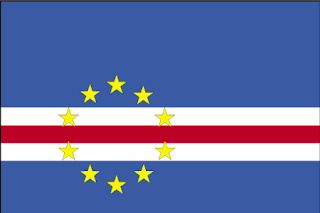
Country Profiles: Cape Verde

Cape Verde is located in Africa.
The uninhabited islands were discovered and colonized by the Portuguese in the 15th century; Cape Verde subsequently became a trading center for African slaves and later an important coaling and resupply stop for whaling and transatlantic shipping. Following independence in 1975, and a tentative interest in unification with Guinea-Bissau, a one-party system was established and maintained until multi-party elections were held in 1990. Cape Verde continues to exhibit one of Africa's most stable democratic governments. Repeated droughts during the second half of the 20th century caused significant hardship and prompted heavy emigration. As a result, Cape Verde's expatriate population is greater than its domestic one. Most Cape Verdeans have both African and Portuguese antecedents.
CIA World Factbook
With an area of 4,033 sq km, it is slightly larger than the U.S. state of Rhode Island.

Cape Verde is a group of islands surrounded by the North Atlantic Ocean. It is mostly steep, rugged, rocky, and volcanic.


People who live in Cape Verde are called Cape Verdeans, which is also an adjective used to describe something from this country. As of July 2012, there are 523,568 people in Cape Verde. The ethnic groups that reside in Cape Verde are mostly Creole (71%) with some African (28%) and European (1%). Portuguese is the official language, but Crioulo (a blend of Portuguese and West African words) is also spoken there. The main religions of Cape Verde are Roman Catholicism (infused with indigenous beliefs) and Protestantism (mostly Church of the Nazarene).

The country's official name is Republic of Cape Verde (or Republica de Cabo Verde). The capital is Praia, and the country is made up of 17 municipalities. Though Cape Verde gained independence from Portugal on July 5, 1975, a constitution was not drafted until September 25, 1992. The constitution can be found here (in Portuguese) through Constitution Finder. The current president is Jorge Carlos de Almeida Fonseca. Information about the leaders of Cape Verde's government can be found here. The currency is the Cape Verdean escudos(abbreviated CVE), which stands at 79.323 CVE per USD as of 2011.


All of this information was gathered from the CIA World Factbook. For more information, check out these resources...

Cape Verde Government Site (in Portuguese)

Cape Verde, CIA World Factbook

Background Notes: Cape Verde, U.S. Department of State

2011 Country Report on Human Rights Practices in Cape Verde, U.S. Department of State.

You can also check out the Country Studies tab on our Fed Docs libguide here for more resources on all of the countries.


Sonnet Ireland
Head of Federal Documents
Reference & Instruction Librarian
Subject Specialist: Legal Research
Planning and Urban Studies
Political Science

Friday, November 30, 2012

60 Minutes (11/25/2012)


Sonnet Ireland
Head of Federal Documents
Reference & Instruction Librarian
Subject Specialist: Legal Research
Planning and Urban Studies
Political Science

Monday, November 26, 2012

Country Profiles: Cameroon

Cameroon is located in Africa.
French Cameroon became independent in 1960 as the Republic of Cameroon. The following year the southern portion of neighboring British Cameroon voted to merge with the new country to form the Federal Republic of Cameroon. In 1972, a new constitution replaced the federation with a unitary state, the United Republic of Cameroon. CIA World Factbook
With an area of 475,440 sq km, it is slightly larger than the U.S. state of California.

Cameroon shares a border with Central African Republic, Chad, Republic of the Congo, Equatorial Guinea, Gabon, and Nigeria. It has a diverse terrain--coastal plain in the southwest, dissected plateau in the center, mountains in the west, and plains in the north.


People who live in Cameroon are called Cameroonians, which is also an adjective used to describe something from this country. As of July 2012, there are 20,129,878 people in Cameroon. The ethnic groups that reside in Cameroon are mostly Cameroon Highlanders (31%), along with Equatorial Bantu (19%), Kirdi (11%), Fulani (10%), Northwestern Bantu (8%), Eastern Nigritic (7%), and other African (13%) and non-African (1%) groups. 24 major African language groups are spoken there, but the two official languages are English and French. Indigenous beliefs make up approximately 40% of the population, while Christian (40%) and Muslim (20%) make up the rest.

The country's official name is Republic of Cameroon. The capital is Yaounde, and the country is made up of 10 regions. Though Cameroon gained independence from the French on January 1, 1960, a constitution was not drafted until May 20, 1972. The constitution can be found here (French only) through Constitution Finder. The current president is Paul Biya. Information about the leaders of Cameroon's government can be found here. The currency is the Cooperation Financiree en Afrique Centrale francs (abbreviated XAF), which stands at 471.87 XAF per USD as of 2011.


All of this information was gathered from the CIA World Factbook. For more information, check out these resources...

Presidency of the Republic, Republic of Cameroon Site

Cameroon, CIA World Factbook

Background Notes: Cameroon, U.S. Department of State

2011 Country Report on Human Rights Practices in Cameroon, U.S. Department of State.

You can also check out the Country Studies tab on our Fed Docs libguide here for more resources on all of the countries.


Sonnet Ireland
Head of Federal Documents
Reference & Instruction Librarian
Subject Specialist: Legal Research
Planning and Urban Studies
Political Science

Monday, November 12, 2012

Country Profiles: Burundi

Burundi is located in Africa. Burundi's first democratically elected president was assassinated after 100 days in office in October of 1993. This triggered the violence between the Hutu and Tutsi groups, which resulted in the death of more than 200,000 Burundians. With an area of 27,830 sq km, it is slightly smaller than the U.S. state of Maryland.

Burundi shares a border with Democratic Republic of the Congo, Rwanda, and Tanzania. It is mostly hilly and mountainous, dropping to a plateau in the east, and with some plains.


People who live in Burundi are called Burundians, which is also an adjective used to describe something from this country. As of July 2012, there are 10,557,259 people in Burundi. The ethnic groups that reside in Burundi are mostly Hutu (Bantu-85%), with some Tutsi (Hamitic-14%), Twa (Pygmy-1%). There are also 3,000 Europeans and 2,000 South Asians who call Burundi home. Burundi has two official languages: Kirundi and French. Swahili is also spoken in parts of Burundi. Catholics make up approximately 62% of the population, while Protestants (5%), Muslims (10%), and indigenous beliefs (23%) make up the rest.

The country's official name is the Republic of Burundi. The capital is Bujumbura, and the country is made up of 17 provinces. Burundi gained independence from the Belgians on July 1, 1963. The constitution can be found here through Constitution Finder. The current president is Pierre Nkurunziza. Information about the leaders of Burundi's government can be found here. The currency is the Burundi francs (abbreviated BIF), which stands at 1,261.1 BIF per USD as of 2011.


All of this information was gathered from the CIA World Factbook. For more information, check out these resources...

Burundi Government Site

Burundi, CIA World Factbook

Burundi, U.S. Department of State

2011 Country Report on Human Rights Practices in Burundi, U.S. Department of State.

You can also check out the Country Studies tab on our Fed Docs libguide here for more resources on all of the countries.


Sonnet Ireland
Head of Federal Documents
Reference & Instruction Librarian
Subject Specialist: Legal Research
Planning and Urban Studies
Political Science

Monday, October 29, 2012

Country Profiles: Burkina Faso

Burkina Faso is located in Africa. Formerly known as Upper Volta, Burkina Faso gained independence from France in 1960. With an area of 274,200 sq km, it is slightly larger than the U.S. state of Colorado.

Burkina Faso shares a border with Benin, Cote d'Ivoire, Ghana, Mali, Niger, and Togo. It is mostly flat to dissected, undulating plains, with hills in the west and southwest.


People who live in Burkina Faso are called Burkinabe, which is also an adjective used to describe something from this country. As of July 2012, there are 17,275,115 people in Burkina Faso. The ethnic groups that reside in Burkina Faso are mostly Mossi (over 40%) with smaller groups of Gurunsi, Senufo, Lobi, Bobo, Mande, and Fulani. Though French is the official language of Burkina Faso, native African languages belonging to Sudanic family is also spoken by 90% of the population. Muslims make up approximately 60.5% of the population, while Catholics (19%), animist (15.3%), and Protestants (4.2%) make up the rest.

The capital of Burkina Faso is Ouagadougou, and the country is made up of 13 regions. Though Burkina Faso gained independence from France on August 5, 1960, a constitution was not adopted until June 11, 1991. The constitution can be found through Constitution Finder. The current president is President Blaise Compaore. Information about the leaders of Burkina Faso's government can be found here. The currency is the Communaute Financiere Africaine francs (abbreviated XOF), which stands at 471.87 XOF per USD as of 2011.


All of this information was gathered from the CIA World Factbook. For more information, check out these resources...

Burkina Faso, CIA World Factbook

Background Notes: Burkina Faso, U.S. Department of State

2011 Country Report on Human Rights Practices in Burkina Faso, U.S. Department of State.

You can also check out the Country Studies tab on our Fed Docs libguide here for more resources on all of the countries.


Sonnet Ireland
Head of Federal Documents
Reference & Instruction Librarian
Subject Specialist: Legal Research
Planning and Urban Studies
Political Science

Monday, August 27, 2012

Country Profiles: Botswana

Botswana is located in Africa. Botswana, formerly the British protectorate of Bechuanaland, gained independence (and its new name) in 1966. Botswana has one of the world's highest known rates of HIV/AIDS infection, but also one of Africa's most progressive and comprehensive programs for dealing with the disease. With an area of 581,730 sq km, it is slightly smaller than the U.S. state of Texas.

COUNTRY shares a border with Namibia, South Africa, and Zimbabwe. It is mostly flat to gently rolling tableland, with the Kalahari Desert to the southwest.


A person who lives in Botswana is called Motswana, but people who live in Botswana are called Batswana, which are also the adjectives used to describe something/somethings from this country. As of July 2012, there are 2,098,018 people in Botswana. The ethnic groups that reside in Botswana are mostly Tswana (or Setswana) 79%, with some Kalanga (11%) and Basarwa (3%). Though the official language is English, several languages are spoken there, including Setswana (78%), Kalanga (8%), and Sekgalagadi (3%). Christians make up approximately 72% of the population, while Badimo make up an additional 6%.

The country's official name is Republic of Botswana. The capital is Gabarone, and the country is made up of 9 districts and 5 town councils. Though Botswana gained independence from the United Kingdom on Setpember 30, 1966, the constitution was actually drafted in March 1965. The constitution can be found here through Constitution Finder. The current president is Seretse Khama Ian Khama. Information about the leaders of Botswana's government can be found here. The currency is pulas (abbreviated BWP), which stands at 6.695 BWP per USD as of 2011.


All of this information was gathered from the CIA World Factbook. For more information, check out these resources...

Botswana Government Site

Botswana, CIA World Factbook

Background Notes: Botswana, U.S. Department of State

2011 Country Report on Human Rights Practices in Botswana, U.S. Department of State

You can also check out the Country Studies tab on our Fed Docs libguide here for more resources on all of the countries.


Sonnet Ireland
Head of Federal Documents
Reference & Instruction Librarian
Subject Specialist: Legal Research
Planning and Urban Studies
Political Science

Monday, May 21, 2012

Country Profiles: Benin

Benin is located in Africa. Benin was once the site of Dahomey, a prominent West African kingdom that rose in the 15th century; it became a territory of France in 1872. With an area of 112,622 sq km, it is slightly smaller than the U.S. state of Pennsylvania.

COUNTRY shares a border with Burkina Faso, Niger, Nigeria, and Togo. It is mostly flat to undulating plains with some hills and low mountains.


People who live in Benin are called Beninese, which is also an adjective used to describe something from this country. It is estimated that by July 2012 there will be close to 9.6 million people in Benin. The ethnic groups that reside in Benin are mostly Fon, Adja, and Yoruba, with some Bariba, Peulh, Ottamari, Yoa-Lokpa, and Dendi. Though French is the official language, Fon, Yoruba, and tribal languages are also spoken there. Catholics make up approximately 27% of the population, while Muslim (24%), Vodoun (17%), and Protestant (10%) make up the rest of the population.

The country's official name is Republic of Benin. The capital is Porto-Novo, and the country is made up of 12 departments. Though Benin gained independence from France on August 1, 1960, a constitution was not adopted until December 2, 1960. The constitution can be found here through Constitution Finder. The current president is Thomas Yayi, and the Prime Minister is Pascal Koupaki. Information about the leaders of COUNTRY's government can be found here. The currency is the Communaute Financiere Africaine francs (abbreviated XOF), which stands at 473.7 XOF per USD as of 2011.


All of this information was gathered from the CIA World Factbook. For more information, check out these resources...

Benin, CIA World Factbook

Background Notes: Benin, U.S. Department of State

2010 Country Report on Human Rights Practices in Benin, U.S. Department of State.

You can also check out the Country Studies tab on our Fed Docs libguide here for more resources on all of the countries.


Sonnet Ireland
Head of Federal Documents
Reference & Instruction Librarian
Subject Specialist: Legal Research, Political Science
Urban and Transportation Studies, Engineering

Monday, January 30, 2012

Country Profiles: Angola

Angola is located in Africa. Angola suffered a 27-year civil war after gaining independence from Portugal. The war ended in 2002. With an area of 1,246,700 sq km, Angola is slightly less than twice the size of Texas.

Angola shares a border with the Democratic Republic of the Congo, the Republic of the Congo, Namibia, and Zambia. Its narrow coastal plain rises abruptly to vast interior plateau.


People who live in Angola are known as Angolans, which is also the adjective used to describe an item from this country. As of July 2011, there were 13.3 million people in Angola. The main ethnic groups that make up Angola include Ovimbundu (37%), Kimbundu (25%), and Bakongo (13%). Though Portuguese is the official language, Bantu and other African languages are also spoken. At 47%, most Angolans practice indigenous beliefs, while others practice Roman Catholicism (38%) and Protestantism (15%).

The country's official name is the Republic of Angola. The capital is Luanda, and the country is made up of 18 provinces. Though Angola gained independence from Portugal in November 1975, a constitution was not adopted until 1992. The constitution can be found here at Constitution Finder. The current president is Jose Eduardo Dos Santos. Information about the leaders of Angola's government can be found here. The currency is the kwanza (abbreviated AOA), which stands at 92.08 AOA per USD as of 2010.


All of this information was gathered from the CIA World Factbook. For more information, check out these resources...


Angola, CIA World Factbook

Background Note: Angola, U.S. Department of State

Angola 2010 Country Report on Human Rights Practices, U.S. Department of State.


Sonnet Ireland
Head of Federal Documents
Reference & Instruction Librarian
Subject Specialist: Legal Research, Political Science
Urban and Transportation Studies, Engineering

Monday, January 16, 2012

Country Profiles: Algeria

Algeria is located in Africa. Algeria achieved independence from French rule in 1962. With an area of 2,381,741 sq km, it is slightly less than 3.5 times the U.S. state of Texas. It is the largest country in Africa.

Algeria shares a border with Libya, Mali, Mauritania, Morocco, Niger, Tunisia, and Western Sahara. It is mostly high plateau and desert with some mountains and narrow, discontinuous coastal plain.


People who live in Algeria are called Algerians, which is also the adjective used to describe something from this country. As of July 2011, there were about 35 million people. 99% of Algerians are Arab-Berber, while the other 1% are European. While Arabic is the official language of Algeria, French and Berber dialects are also spoken. Sunni Muslims is the state religion with 99% of the population; the other 1% are Christian and Jewish.

The country's official name is People's democratic Republic of Algeria. The capital is Algiers, and the country is made up of 48 provinces. The Constitution was first written in September 1963 and can be found here on Constitution Finder. The current president is President Abdelaziz Bouteflika. Information about the leaders of Algeria's government can be found here. The currency is Algerian dinars (abbreviated DZD), which stands at 76 DZD per USD as of 2010.


All of this information was gathered from the CIA World Factbook. For more information, check out these resources...

Algeria, CIA World Factbook

Background Note: Algeria, U.S. Department of State

Algeria 2010 Country Report on Human Rights Practices, U.S. Department of State

You can also check out the Country Studies tab on our Fed Docs libguide here for more resources on all of the countries.

Sonnet Ireland
Head of Federal Documents
Reference & Instruction Librarian
Subject Specialist: Legal Research, Political Science
Urban and Transportation Studies, Engineering